

GREENVALLEY LiAir H600MS Long-Range LiDAR & Multispectral Sensor System for DJI Drones
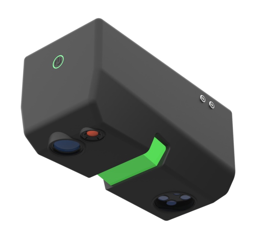
The GREENVALLEY LiAir H600MS is an advanced multi-sensor airborne mapping system designed for high-precision surveying, 3D modelling, precision agriculture, forestry, infrastructure inspection, mining, and industrial applications. Combining long-range LiDAR, 14-channel multispectral imaging, thermal infrared sensing, and a 26 MP RGB camera into one lightweight payload, the LiAir H600MS delivers reliable, high-resolution geospatial data for demanding professional workflows.
Built for seamless integration with DJI Matrice 400 and DJI Matrice 350 RTK drones, the system provides efficient and safe aerial data acquisition with excellent accuracy and operational flexibility. The integrated 1550nm LiDAR sensor measures distances up to 750 meters with millimeter-level precision, while the multispectral array captures detailed vegetation and environmental analysis across 14 spectral bands.
The built-in VOX thermal infrared camera supports full-screen temperature measurement for inspection, search operations, utilities, solar farms, and industrial monitoring. A high-resolution 26 MP RGB camera enables detailed orthophoto generation and realistic point cloud texturing for BIM, engineering, and mapping projects.
With an integrated high-precision INS supporting GPS, GLONASS, BeiDou, and Galileo, the LiAir H600MS ensures stable and accurate positioning performance even in challenging environments. Its lightweight design under 2.2 kg maximizes drone flight endurance and operational efficiency in the field.
Ideal for airborne laser scanning (ALS), terrain modelling, topographic mapping, deformation analysis, construction supervision, utility inspection, forestry management, and precision agriculture, the GREENVALLEY LiAir H600MS offers a powerful all-in-one solution for modern geospatial professionals.
Key Features
Integrated LiDAR, multispectral, thermal IR, and RGB imaging system
14-channel multispectral sensing for advanced vegetation analysis
Long-range LiDAR scanning up to 750 m
5 mm accuracy at 100 m
26 MP RGB mapping camera for detailed orthophotos
Thermal infrared imaging with full-screen temperature measurement
Lightweight payload under 2.2 kg
Compatible with DJI Matrice 400 and Matrice 350 RTK
High-precision INS with GNSS multi-constellation support
Professional solution for surveying, BIM, agriculture, mining, and utilities
Applications
Airborne Laser Scanning (ALS)
Precision Agriculture
Forestry & Environmental Monitoring
BIM & Construction Documentation
Utility & Powerline Inspection
Mining & Quarry Surveying
Oil & Gas Infrastructure Inspection
Solar & Wind Energy Inspection
Topographic Mapping
3D Terrain & DEM/DSM Modelling
Industrial Plant Documentation
Emergency Response & Thermal Inspection
Reviews
There are no reviews yet.